ΑΓΓΕΛΙΑ
ΕΝΟΙΚΙΑΖΕΤΑΙ ΟΙΚΟΠΕΔΟ 1760 Μ2- ΛΑΘΕΑ Α’ ΑΧΑΡΝΕΣ,πλησίον supermarket “ΣΚΛΑΒΕΝΙΤΗ» Λεωφόρου Πάρνηθος
ΕΠΙΚΟΙΝΩΝΙΑ:210-2449325
NASA Earthdata
| | | | | | | | | National Aeronautics and Space Administration |
| |  | | | | | | | |
|
| | | | | | | |  | | | March 2025 | | | Open Access for Open Science |
| |
|
| | | | | |  | | | | | | | | | | | | | | | | In her address to the Geographic Information Systems (GIS) community, our Earth Data Officer, Katie Baynes, highlights the many ways NASA’s Earth science data informs crucial action on the ground—including disaster management, agriculture planning, and air quality monitoring. View the StoryMap for a full recap. | | | | | |
| | | | | | | Earthdata provides a range of tutorials, data recipes, tools, and services to help GIS users analyze data, create maps, and develop applications. | ➞ | | | | | | |
| | | | |  | | Articles | | | | | |
|
| | | | | |  | | The Harmonized Landsat Sentinel-2 Project Releases Vegetation Indices
NASA’s Harmonized Landsat and Sentinel-2 (HLS) project released two new products: the Landsat 30-meter Vegetation Index and Sentinel-2 30-meter Vegetation Index. Each product contains a suite of nine vegetation indices with applications including, agriculture, forest monitoring, vegetation health, and wildfire. | | | | | | | | 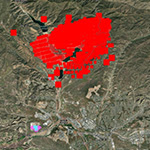 | | FIRMS Releases New Features to Identify Active Fires by Type
Users of NASA’s Fire Information for Resource Management System (FIRMS) can now differentiate between fires caused by burning vegetation and fires from natural heat sources or industrial heat sources. | | | | | | | | 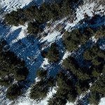 | | X-Snow Project Fills Gap in East Coast Snow Data
A new citizen science project called X-Snow pairs with residents in the Catskill region of New York to measure snowfall and share validation data for NASA’s remote sensing snow measurements and models and for local pollution, climate, and environmental research. | | | | | | | | 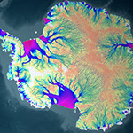 | | Analysis and Review of CMR Project Checks NISAR Metadata
In preparation for NISAR—the NASA/ISRO (Indian Space Research Organisation) Synthetic Aperture Radar mission—NASA is working to ensure that mission data can be integrated into the Common Metadata Repository (CMR), a crucial step in confirming data pipeline readiness. | | | | | | | |  | | Mean Night Temperature Anomalies in January 2025
The January 2025 analysis of Atmospheric Infrared Sounder (AIRS) surface temperature data and Integrated Multi-satellite Retrievals for GPM (IMERG) precipitation data from NASA’s Goddard Earth Sciences Data and Information Services Center (GES DISC) confirmed an unusual weather pattern that led to anomalously cold temperatures and snow in the southeastern United States. In Canada and Alaska, however, it was unusually warm. | | | | | | | | | |
| | | | | | NASA's Earth Science Data and Information System (ESDIS) Project is gathering feedback from our stakeholder community to better understand how data users discover, access, and work with earth science data. It should take approximately 10-15 minutes to complete. All responses are confidential and the information we gather will be invaluable to helping us improve the user experience of our web-based data tools. | | | | | |
| | | | | |  | | Webinars & Events | | | | | |
|
| | | | | | | | NASA CSDA Program Vendor Focus—GHGSat Recorded March 19, 2025 GHGSat, a NASA Commercial Satellite Data Acquisition (CSDA) program vendor, provides access to commercial methane emissions data products. Learn how GHGSat scientists access and work with these products, and which research topics the data is best suited for as a point source monitoring system.
| |  | | | | | | | | | | NASA CSDA Program Vendor Focus—Airbus Recorded February 19, 2025 The NASA Commercial Satellite Data Acquisition (CSDA) program vendor Airbus provides the NASA community with optical and Synthetic Aperture Radar (SAR) products and services, including elevation data and ground control points. Learn how to task Airbus satellites and order high resolution archive and elevation data.
| |  | | | | | | | |
| | | | |  | | New Data, Tutorials, & Resources | | | | | |
| | | | | |  | | Worldview Images of the Week | | | | | |
| |  | | Dust Blowing Across the U.S. NASA’s Advanced Baseline Imager (ABI) captured dust blowing from Mexico, New Mexico, and Texas that was then picked up by a storm system that swept across the U.S. | | | | | | | |  | | High Chlorophyll a Concentrations in the Gulf of Oman and Arabian Sea Images acquired by the Ocean Color Instrument (OCI) aboard the Plankton, Aerosol, Cloud, ocean Ecosystem (PACE) platform are overlaid with Worldview’s Chlorophyll a layer, which provides the near-surface concentration of chlorophyll a in milligrams of chlorophyll pigment per cubic meter in the ocean. | | | | | | | |  | | Flooding in Arkansas, Tennessee, Kentucky, and Indiana, USA View imagery comparison that shows flooding across the U.S. on February 25, 2025, due to heavy rains associated with a massive winter storm. | | | | | | | |  | | Iceberg A23a Grounded Near South Georgia Island Iceberg A23A has run aground, as shown in a false-color corrected reflectance (Bands 7-2-1) image from the Moderate Resolution Imaging Spectroradiometer (MODIS) aboard the Aqua platform on March 4, 2025. | | | | | | | |  | | Swirling Clouds in the Atlantic Ocean Imagery from MODIS aboard the Terra platform reveals patterns of swirling clouds, known as von Kármán vortices or Karman vortex streets, above the Cabo Verde islands. | | | | | |
| | | | | | NASA's Earth Science Data Systems (ESDS) Program oversees the life cycle of NASA’s Earth science data and seeks to maximize the scientific return from missions and experiments. | | | | | |
|
|

| NASA8800 Greenbelt Rd.Greenbelt, MD 20771 |
|
|
Digital Υπηρεσίες Επικοινωνίας
✍️ Content & άρθρα (news, social, πολιτική)
🎧 Transcription & μετατροπές κειμένων
📢 Copywriting για brands & υπηρεσίες
🌐 Blog setup & content management
📄 CV writing (Europass & σύγχρονα formats)
⌨️ Data entry & document formatting
📝 Πρακτικά & απομαγνητοφώνηση
📊 Market research & online insights
📞 6998069746
📧 webekdossis@gmail.com
Tι ήταν η ΕΦΗΜΕΡΙΔΑ «ΠΟΛΙΤΙΚΗ»..για όσους δεν γνωρίζουν.
Η «ΠΟΛΙΤΙΚΗ» γεννήθηκε το 2000,ως συνέχεια του Περιοδικού «ΑΧΑΡΝΕΩΝ Έργα». Δημιουργήθηκε από Επαγγελματίες Εκδότες με δεκαετίες στον τομέα της Διαφήμισης, των Εκδόσεων και των Δημοσίων Σχέσεων και αρχικά ήταν μια Υπερτοπική Εφημερίδα με κύριο αντικείμενο το Αυτοδιοικητικό Ρεπορτάζ.
Επί χρόνια, κυκλοφορούσε την έντυπη έκδοσή της σε ένα ικανότατο τιράζ (5000 καλαίσθητων φύλλων εβδομαδιαίως) και εντυπωσίαζε με την ποιότητα της εμφάνισης και το ουσιώδες, μαχητικό και έντιμο περιεχόμενο της.
Η δύναμη της Πένας της Εφημερίδας, η Ειλικρίνεια, οι Ερευνές της που έφερναν πάντα ουσιαστικό αποτέλεσμα ενημέρωσης, την έφεραν πολύ γρήγορα πρώτη στην προτίμηση των αναγνωστών και γρήγορα εξελίχθηκε σε Εφημερίδα Γνώμης και όχι μόνον για την Περιφέρεια στην οποία κυκλοφορούσε.
=Επι είκοσι έξι (26) χρόνια, στηρίζει τον Απόδημο Ελληνισμό, χωρίς καμία-ούτε την παραμικρή- διακοπή
.
=Επί είκοσι έξι ολόκληρα χρόνια, προβάλλει με αίσθηση καθήκοντος κάθε ξεχωριστό, έντιμο και υπεύθυνο Πολιτικό της Πολιτικής Σκηνής. Στις σελίδες της, θα βρείτε ακόμα και σήμερα μόνο άξιες και χρήσιμες Πολιτικές Προσωπικότητες αλλά και ενημέρωση από κάθε Κόμμα της Ελληνικής Βουλής. Η «ΠΟΛΙΤΙΚΗ» ουδέποτε διαχώρησε τους αναγνώστες της ανάλογα με τα πολιτικά τους πιστεύω. Επραττε το καθήκον της, ενημερώνοντας όλους τους Ελληνες, ως όφειλε.
=Επί είκοσι έξι ολόκληρα χρόνια, δίνει βήμα στους αδέσμευτους, τους επιτυχημένους, τους γνώστες και θιασώτες της Αλήθειας. Στηρίζει τον Θεσμό της Ελληνικής Οικογένειας, την Παιδεία, την Ελληνική Ιστορία, προβάλλει με όλες της τις δυνάμεις τους Αδελφούς μας απανταχού της Γης, ενημερώνει για τα επιτεύγματα της Επιστήμης, της Επιχειρηματικότητας και πολλά άλλα που πολύ καλά γνωρίζουν οι Αναγνώστες της.
=Επί είκοσι έξι ολόκληρα χρόνια, ο απλός δημότης–πολίτης, φιλοξενείται στις σελίδες της με μόνη προϋπόθεση την ειλικρινή και αντικειμενική γραφή και την ελεύθερη Γνώμη, η οποία ΟΥΔΕΠΟΤΕ λογοκρίθηκε.
Η ΕΦΗΜΕΡΙΔΑ «ΠΟΛΙΤΙΚΗ», είναι ένα βήμα Ισονομίας και Ισοπολιτείας, έννοιες απόλυτα επιθυμητές, ιδιαιτέρως στις ημέρες μας. Είναι ο δικτυακός τόπος της έκφρασης του πολίτη και της εποικοδομητικής κριτικής, μακριά από κάθε στήριξη αφού ΟΥΔΕΠΟΤΕ ετύγχανε οικονομικής υποστήριξης από Δήμους, Κυβερνήσεις ή όποιους άλλους Δημόσιους ή Ιδιωτικούς Φορείς, δεν είχε ΠΟΤΕ χορηγούς, ή οποιασδήποτε μορφής υποστηρικτές. Απολαμβάνει όμως Διεθνούς σεβασμού αφού φιλοξενεί ενημέρωση από αρκετά ξένα Κράτη πράγμα που της περιποιεί βεβαίως, μέγιστη τιμή.
Η ΕΦΗΜΕΡΙΔΑ «ΠΟΛΙΤΙΚΗ» διαγράφει απο την γέννησή της μια αξιοζήλευτη πορεία και απέκτησε εξ αιτίας αυτού,ΜΕΓΙΣΤΗ αναγνωσιμότητα.
Η Εφημερίδα «ΠΟΛΙΤΙΚΗ» κέρδισε την αποδοχή και τον σεβασμό που της ανήκει, με «εξετάσεις» εικοσι έξι ολόκληρων ετών, με συνεχείς αιματηρούς αγώνες κατά της τοπικής διαπλοκής, με αγώνα επιβίωσης σε πολύ δύσκολους καιρούς, με Εντιμότητα, αίσθηση Καθήκοντος και Ευθύνης.


Σχόλια
Δημοσίευση σχολίου
Eυπρόσδεκτα τα σχόλιά Σας...