| | | | | | | |  | | | | OPEN ACCESS FOR OPEN SCIENCE | MAY 2023 |
| | | | | | | |
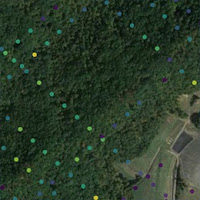
| | | | | | |  | | | | | | | | | | | | | | | | Citizen science is a form of open collaboration in which individuals or organizations participate voluntarily in the scientific process. Learn more about how citizen science projects are enhancing NASA’s Earth science data collection. | | | | | |
| | | | | | | A new NASA funding opportunity is available for early career Earth scientists. | Learn More | | | | | | |
| | | | |  | | Articles | | | | | |
| | | | | | |  | | Hydrology in High Mountain Asia
Dr. Fadji Z. Maina relies on NASA data in her studies into how changes in the hydrologic cycle are impacting a mountainous region that is home to more than a billion people. | | | | | | | |  | | Tracking a Snowstorm for the Record Books
Between November 16 and 20, 2022, areas near Buffalo, NY, recorded more than six feet of snow. East of Watertown, NY, totals approached four feet. A new Data-in-Action story uses science model datasets to examine this extreme lake effect snow event. | | | | | | | |  | | Data Tool in Focus: AppEEARS
The Application for Extracting and Exploring Analysis Ready Samples (AppEEARS) allows users to subset data spatially, temporally, and by layer, reducing the amount of data they need to download. | | | | | |
| | | | |  | | Earthdata Cloud Evolution | | | | | |
| | | | | | PO.DAAC Data Move to the Earthdata Cloud All data archived by NASA’s Physical Oceanography Distributed Active Archive Center (PO.DAAC) are now in the Earthdata Cloud, and on-premises data access tools and services have been retired. PO.DAAC is the first DAAC to complete this migration. | | | | | | | | LAADS DAAC Completes Phase 1 Dataset Migration NASA’s Level 1 and Atmosphere Archive and Distribution System DAAC (LAADS DAAC) completed Phase 1 of its migration of data to the Earthdata Cloud. Phase 2 is expected to be completed later in 2023. | | | | | |
| | | | | | | The Earthdata Cloud makes it easier to work with NASA Earth science data. | Learn How | | | | | | |
| | | | | |  | | Webinars & Events | | | | | |
| | |  | | Terra, Aqua, and Aura Data Continuity Workshop The May 23-25 open online workshop will determine needs, evaluate current capabilities, identify gaps, and specify potential actions for NASA’s Terra, Aqua, and Aura mission data. | | | | | | | |  | | OPERA Workshop (Hybrid)
The Observational Products for End-Users from Remote Sensing Analysis (OPERA) project’s third open workshop takes place June 27 from 9 a.m. to 3 p.m., PDT, on the Caltech campus in Pasadena, CA. | | | | | | | |  | | NASA and CERN to Host Open
Science Summit
NASA and the European Organization for Nuclear Research (CERN) are coordinating a week-long summit July 10-14 to develop practical action plans to implement open science practices. | | | | | |
| | | | |  | | New Data | | | | | |
| | Use Python to Access the GIBS API NASA’s Global Imagery Browse Services (GIBS) provides visualizations of NASA Earth science observations through standardized web services. Accessing via Python is the newest addition to the GIBS Application Programming Interface (API) documentation. | | | | | | | | Tracking Vegetative Growth Across North America A new Land Surface Phenology, Eddy Covariance Tower Sites, North America, 2017-2021 dataset provides spatial data related to phenological changes (start, peak, and end of vegetation activity), vegetation index metrics, and more. | | | | | | | | Data for Western U.S. Snow NASA SnowEx 2020 and 2021 campaign datasets provide digital elevation models, snow depth, and vegetation height for multiple areas in Colorado, Idaho, and Utah. | | | | | | | | OPERA Dynamic Surface Water Extent Provisional The second product release from the Observational Products for End-Users from Remote Sensing Analysis (OPERA) project, Surface Water Extent, can be viewed in NASA Worldview. This Level 3 product maps surface water every few days. | | | | | | | | New Nitrogen Dioxide Surface Value Dataset NASA’s Health and Air Quality Applied Sciences Team (HAQAST) has released a new global Nitrogen Dioxide Surface-Level Annual Average Concentrations dataset. The data are global over land and cover areas between 60° south and 75° north latitude. | | | | | | | | VIIRS Deep Blue Aerosol v2.0 Products Available The Version 2.0 (v2.0) of the Deep Blue Aerosol global product suites are derived from the NOAA-20 Visible Infrared Imaging Radiometer Suite (VIIRS) and the Suomi National Polar-orbiting Partnership (Suomi NPP) VIIRS instrument sources. | | | | | | | | Detailed Air Quality Estimates for Public Health Research Two new air quality datasets provide high resolution estimates of particulate matter (PM2.5) chemical components and trace elements in urban and non-urban areas of the U.S. from 2000 to 2019. | | | | | | | | Tracking Wildfire Emissions in Southeast Asia The Fire Particulate Emissions for Indonesia, 2015-2020 dataset provides fire emissions data across the Republic of Indonesia. | | | | | | | | New Spectroscopy Data Source Wondering if space-based spectroscopy data are available at your study site? The Earth Surface Mineral Dust Source Investigation (EMIT) open data portal shows collected and forecasted data coverage. | | | | | | | | Sea Surface Temperature Data Animation A new data animation shows daily global reprocessed foundation Sea Surface Temperature (SST) mapped on a regular grid from January 2020 to May 2022. | | | | | | | | Projected Climate Risks for U.S. Counties The U.S. Climate Risk Projections by County, 2040-2049 dataset contains risk projections for the entire contiguous U.S. at the county level with a novel climate risk index integrating multiple hazards, exposures, and vulnerabilities. | | | | | |
| | | | | |  | | Open Science | | | | | |
| | | | | |  | | Funding Opportunity | | | | | |
| | | | | |  | | Connect with NASA Earth Science | | | | | |
| | The following forums, meetings, and conferences highlight NASA Earth science data and many feature participation by NASA Earth science data creators and providers. These are great opportunities to meet the people behind the data. | | | | | | | | Japan Geoscience Union Meeting 2023 Date: May 21-26 Location: Chiba City, Japan/Virtual | | | | | | | | American Astronomical Society Date: June 4-8 Location: Albuquerque, NM/Virtual | | | | | | | | American Library Association Annual Conference and Exhibition Date: June 22-27 Location: Chicago, IL/Virtual | | | | | | | | Esri User Conference Date: July 10-14 Location: San Diego, CA/Virtual | | | | | | | | International Union of Geodesy and Geophysics (IUGG) Date: July 11-20 Location: Berlin, Germany | | | | | | | | International Geoscience and Remote Sensing Symposium (IGARSS) Date: July 16-21 Location: Pasadena, CA | | | | | | | | Earth Science Information Partners (ESIP) Summer Meeting Date: July 18-21 Location: Burlington, VT/Virtual | | | | | | | | Asia Oceania Geosciences Society (AOGS) Annual Meeting Date: July 30-August 4 Location: Singapore | | | | | | | | Optica Sensing Congress Date: July 30-August 3 Location: Munich, Germany/Virtual | | | | | | | | Ecological Society of America (ESA) Annual Meeting Date: August 6-11 Location: Portland, OR | | | | | | | | American Chemical Society Fall Meeting Date: August 13-17 Location: San Francisco, CA/Virtual | | | | | |
| | | | | |  | | Worldview Images of the Week | | | | | |
| | | | | | NASA's Earth Science Data Systems (ESDS) Program oversees the life cycle of NASA’s Earth science data and seeks to maximize the scientific return from missions and experiments. |
|
|
|